The Caspian crossing: the Middle Corridor's sea leg — routes, capacity, weather
The Caspian is the Middle Corridor's key — and tightest — link: this is where cargo is transferred from rail to ferry and back. Using open sources, we break down how the crossing works, how long it takes, what vessels sail, how much the ports can handle, the development plans and how weather affects the schedule.
What the Caspian crossing is
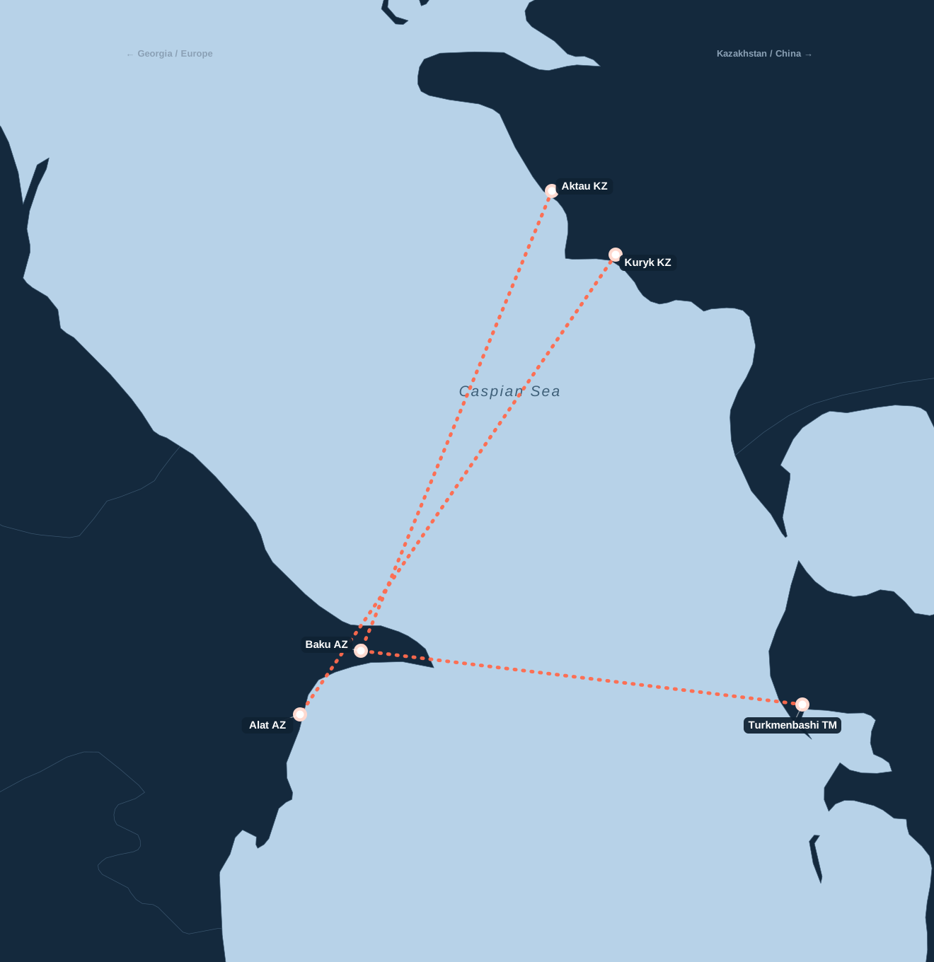
It is the ferry leg between Kazakhstan and Azerbaijan — the central section of the Middle Corridor. Cargo (containers, railcars, ro-ro units) is carried by sea from the eastern shore of the Caspian to the western one: from the ports of Aktau and Kuryk (Kazakhstan) to the port of Baku/Alat (Azerbaijan, about 70 km south of the old Baku harbour). There is also a Turkmen leg — from the port of Turkmenbashi (Turkmenistan) to Baku.
Routes, distances and timing
| Route | Departure port | Sailing time |
|---|---|---|
| Aktau → Baku/Alat | Aktau (Kazakhstan) | 18–20 h (~253 nm) |
| Kuryk → Baku/Alat | Kuryk (Kazakhstan) | under 24 h |
| Turkmenbashi → Baku | Turkmenbashi (Turkmenistan) | ~17 h |
The sailing itself is short — 17 to 24 hours. Most of the time is lost not in transit but before and after it.
What vessels sail
Rail ferries and RoRo (roll-on/roll-off) ships operate across the Caspian. A typical ferry holds about 28–52 railcars. The fleet is still limited, which is what creates queues.
Why it is the bottleneck
The main problem is not the crossing but waiting for a berth and a vessel. There is no real timetable: Aktau–Baku sailings run roughly every 3–5 days (more often to Turkmenbashi). Add a limited number of ferries, outdated transshipment equipment and slow container handling — and time on this leg can be twice as long as on alternative routes. So the ferry has to be planned in advance.
Port capacity
| Port | Capacity |
|---|---|
| Aktau (KZ) | ~12M t/year; container hub (2025) +100k TEU |
| Kuryk (KZ) | ro-ro berth 1.9M t, rail berth 4.1M t |
| Aktau + Kuryk | ~22M t/year total; target ~240k TEU by end 2026 |
| Baku/Alat (AZ) | up to 25M t/year, up to 500k TEU; BISTP 150→260k TEU |
For scale: the Middle Corridor's total container traffic in 2025 was about 77,000 TEU, with a target of 300,000 TEU by 2029. In other words, the crossing is a bottleneck that is actively being widened.
Development plans
The Caspian leg is being reinforced on several fronts:
- Fleet: three new container ships should double the cargo capacity of the Aktau–Baku line; a Georgian company is launching 6 ferries on Kuryk–Alat (two already in the Caspian, starting in the first half of 2026), and Kazakhstan is expanding its fleet through 2028.
- Ports: Kuryk — up to 10M tonnes/year by 2030; Baku/Alat — up to 25M tonnes/year and up to 500,000 TEU; the BISTP container terminal — up to 260,000 TEU.
- Uzbekistan is increasing transit through Kazakhstan's Caspian ports, adding cargo base to the corridor.
Weather and seasonality
The Caspian is a difficult sea to navigate, and that has to be built into the schedule:
- Cyclones: about 73% of storms fall in autumn and winter; peaks in January, March and October.
- Ice: the northern and north-eastern Caspian freezes from November to March; ice can reach Kuryk in the east.
- Storms: in winter the north sees gale-force winds and sharp temperature swings.
For cargo this means restricted vessel drafts, fewer sailing days and temporary route suspensions. The hardest period is autumn and early spring, when the ferry is best planned with a buffer.
The falling Caspian level
A separate, longer-term factor: the sea level has dropped to its lowest in about 400 years and is falling 9–35 cm a year. This threatens reduced vessel loads, higher dredging costs and disruption to port operations — another argument for investment in new ships and terminals.
What comes next on the route
After the Caspian, cargo goes through Georgia (the ports of Poti and Batumi) → the Black Sea → Ukraine. How the whole route works is in Middle Corridor: how cargo travels from Asia bypassing Russia, and its growth and investment are in The Middle Corridor grows 6x.
Summary
The Caspian crossing is where time is most often lost: a short sailing, but unpredictable ferry waits and capricious weather. Planning the connections here is critical. We arrange Asia → Georgia → Ukraine delivery along the Middle Corridor with the Caspian leg accounted for — send a request.
Get a delivery quote